
|
|
|
The waves of 1979. Erosion on Majuro Atoll A Photo Essay by Dirk HR Spennemann |
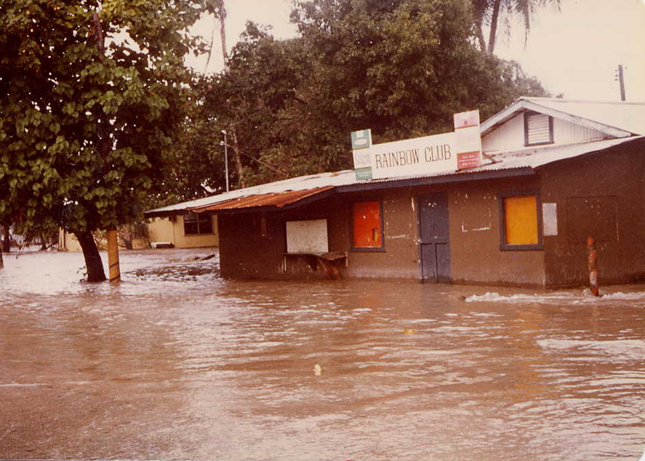
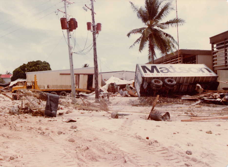
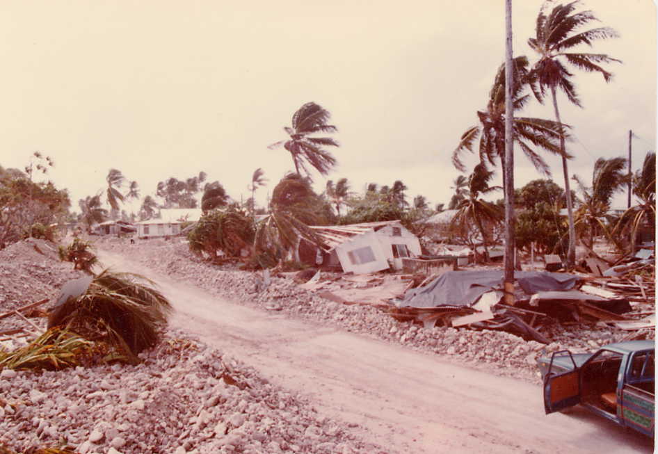
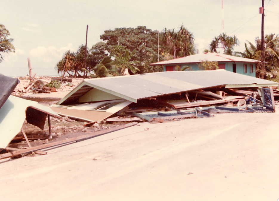
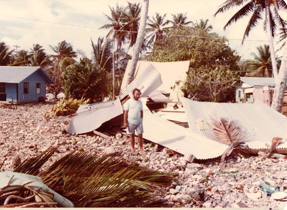
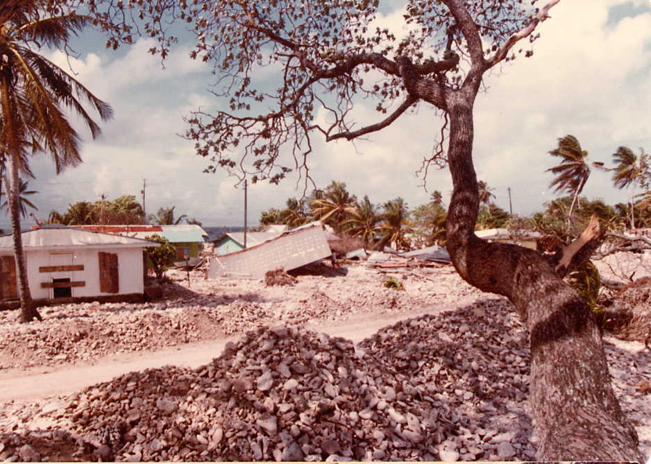
In late November 1979 a subtropical high pressure system had formed some 2000 miles east of the Marshall Islands. Tropical Storm Alice approached the Marshall Islands as close as 40nm east of Kwajalein Atoll (9deg. 00sec. N 166deg. 05sec. E), creating higher than normal sea-level at its perimeter, as well as creating a storm surge, sent out as a swell with a wave amplitude of over 20 feet. The first set of waves inundated parts of the D-U-D area in the morning of 26 November 1979. Since the weather forecast came too late, there was no warning and a great deal of personal belongings were devastated. During the night of 27 to 28 November a second inundation occurred, and a third inundation took place on 4 December when a third storm hit Majuro (7deg. 03sec. N 171deg. 30sec. E), this time accompanied by gale-force winds and a 20foot surf. Before the second tidal surge hit the atoll, some 4000 residents of the already devastated D-U-D area had been warned well ahead and had relocated themselves to Laura. On the morning of 28 November some 80% of the affected area was still covered by seawater. This high tide was made worse by the strong winds pushing the water masses into the areas of the former lagoonal openings, now barred by causeways . |
 |
 |
 |
 |
 |
 |
 |
[Environment] [Atolls of the Marshall Islands]Bibliographic citation for this documentSpennemann, Dirk H.R. (2002). The waves of 1979. Erosion on Majuro Atoll--A Photo Essay. URL: http:/marshall.csu.edu.au/Marshalls/html/Environment/MajuroErosion79.htmlCONTACT: Dirk H.R. Spennemann, Institute of Land, Water and Society, Charles Sturt University, P.O.Box 789, Albury NSW 2640, Australia. e-mail: dspennemann@csu.edu.au |